
Go to many affluent communities in North America and you notice some kind of safe cycling path. Not on the South Fork of Long Island.
You do see, outside of winter, some intrepid bicyclists—occasionally I am one. A few streets have designated bike lanes, where vehicles shouldn’t be blocking, but rarely do these extend for long stretches.* Except for the periodic weekend bike rallies where there’s official escort and safety in numbers, it’s a hazardous activity. Especially is this true on the east-west corridors, where traffic of all kinds is barreling along tight roads to avoid congestion on the main highway 27.
Why this dearth? There’s the older explanation, and the more recent (30-plus years) one.
The long historical context is that the South Fork (aka “Hamptons”) became a destination without having a core vacation hub or even wanting to be a resort. It was a collection of old fishing and farming districts separated by woodlands even as wealthy people adopted it as a seasonal or weekend retreat. Everybody’s desire was to keep the beautiful place the way it was “before.” Result: no new infrastructure that would accommodate a larger and active population, including bike paths (and sidewalks). Way back when, kids in the area’s towns could bike ride along sleepy roads with little care–even to school! Then, one day in the gilding of the Hamptons, nobody could anymore.
Sure, some streets near the ocean are safe enough for summer pedaling. (Ocean Road in Bridgehampton has a bike lane extending all the way to the 27 Hwy.) Even fronting the coast, however, there’ve been struggles in the modern era. In Amagansett, garden-landscape shop owner Charlie Whitmore recalls his father and mother, both longtime local fixtures, pressing for bike lanes along the popular Further Lane-Indian Wells Road-Bluff Road coastal stretch in the 1960s and early 1970s. The East Hampton town highway department ultimately improved the pavement, and a bit of sidewalk exists, but there’s still no secure path there, or anywhere else on the East End.
This, while New York State is actually a standout in this vein. The Empire State Trail, using disused rail lines and canal sidings, is off-road for most of its 750 miles. A strikingly good asphalt section runs from Van Cortlandt Park in the Bronx past the New Croton Reservoir in Westchester County and then well into the Hudson Valley. (A stretch near Yorktown Heights is shown above.)
It’s not that riding routes don’t exist on Long Island. Newsday has spotlighted two dozen such paths, not including the newest and nearest to the East End, the North Shore Rail Trail from Mount Sinai to Wading River in Brookhaven town. The Trust for Public Land, pursuant to a $3.8 million federal infrastructure grant last year, is fashioning plans for a mostly-protected bike route through Suffolk County to Montauk—an attempt, along with earlier funding for Nassau County, to bring Long Island up to the New York standard. The East End’s section will come last, although a “conceptual” map for the South Fork appeared at the group’s website in April.
If that effort proceeds, it will have to surmount obstacles that met previous pushes, and here we have the recent (30-year) story.
In the early 1990s, well into the rush of Manhattan money to the South Fork, an initial bid for a cycling trail came from naturalist Mike Bottini, then affiliated with what is now the Group for the East End. Armed with potential federal highway money, Bottini laid out a route that hugged the Long Island Rail Road line for 12 miles from Southampton to Amagansett. After a slow build, it got support from both the Southampton and East Hampton town boards, and a four-mile stretch in the middle, heading east from where the SoFo nature center now sits on Bridgehampton-Sag Harbor Turnpike, went through Southampton official review in 1999. But by summer 2000, it was drawing flak from some adjoining property owners and others who thought money should go for road repair.
Nonetheless, a Southampton Press editorial in August 2000 said “the question, it seems, is not whether the path will be constructed, but when.”
Bottini persisted, stressing the route’s appeal in connecting various civic activity spots. The thinking was that the paved trail would have utility not just for committed cyclists but for a wider population wanting to transit between such sites without venturing onto hectic Montauk Highway. He met resistance in the village of East Hampton, out of expressed safety fears. Objections also came from an environmental flank: Friends of the Long Pond Greenbelt up the northern spine of Bridgehampton didn’t want pavement or cyclists crossing its preserved territory. (As it happens, the long-abandoned LIRR line to Sag Harbor runs through the Greenbelt.)
Bottini, by then representing a cycling group, was still pitching the idea in the Press in 2009. But a window had closed. Eventually that four-mile stretch amounted to a series of on-street bike lanes, not much different from what exists in other parts of the South Fork. The rest of the 12 miles were largely forgotten.
On-street lanes or “routes” (which have less demarcation) were the focus of an official Southampton town advisory committee report issued in 2007. The town board, still sympathetic to cycling alternatives, accepted the findings, which notably called for expensive widening of key routes. “Crucial,” the panel wrote, were Noyac Road along the northern tier and the primary “back road” vehicle alternative to Montauk Highway (27), which features Head of Pond and Scuttlehole Roads. These two are the inescapable east-west routes—narrow and busy with trucks and cars–for any cyclist wanting to go from town hamlet to hamlet east of the Shinnecock Canal while avoiding the 27.
Accepting a report, however, is not the same as implementing one. By 2008, a global financial crisis had put a (temporary) dent in the Hamptons ardor and political winds would shift. Although minor route enhancements with signage were made, the costly property acquisitions needed for road widening were not.
The issue came to the fore in 2011 when Tom Neely, then Southampton town’s traffic-safety chief**, led a “Complete Streets” drive to address cyclist and pedestrian concerns. The Scuttlehole Road stretch was central, but a new town highway superintendent, Alex Gregor, had been elected and he was not sympathetic. At a board meeting Gregor offered a figure approaching a million dollars for the cost of the project, and the idea sank.
Another repeated target has been the Noyac area bordering on Sag Harbor and the Long Beach bayfront. A formal cost estimate for bike lanes from Gregor’s staff in 2014 came to nearly $800,000, mostly for road widening. The plan came to naught. But the general area has stayed in “traffic calming” focus, and a decade later the town, using new state money, now intends a major sidewalks project there. Ostensibly it’s for children and other pedestrians, but cycling on sidewalks is legal in Southampton town (and most of East Hampton) so there is, well, room for maneuver.
Are the South Fork winds shifting back in favor of accommodating cyclists, either recreational or commuting? It may be notable that Suffolk County is increasingly courting tourism. Southampton town will soon end up with a short offroad stretch for biking as part of a Hampton Bays hamlet route linking Good Ground Park with Red Creek Park. East Hampton is eyeing parking fees as a way to fund bicycle lanes. For now, however, separation from vehicular traffic is one of many obstacles facing day-to-day cyclists, as a Quixotic East Hamptonite recently found.
The cost of any land acquisitions has burgeoned as homes filled many of the wood and farm lots over the decades, and each potential neighbor is a potential objector. The LIRR’s right of way is jealously guarded by the Metropolitan Transportation Authority, even if safe sharing was possible. (Low-cost hacks such as “Toronto barriers” do make it possible to separate bikes from ordinary road traffic.) The LIPA power line that cuts across miles of open moraine on the South Fork is inviting, but also has easement issues, as well as terrain that would require heavy grading in stretches—adding to cost and opposition. And, recalling Mike Bottini’s case decades ago, LIPA’s line is a long way from activity nodes.
Thus the TPL Greenway planners will have big hurdles to clear once their effort moves east. So far, so good—the Southampton town board agreed this month to participate. But seed money is only a start; the choices get harder. And to add to the mix, bikes and other two-wheel transit has become an acute token of cultural controversy across the U.S.—even in San Francisco as well as New York City.
In the meantime, cyclists on the South Fork will have to pick their spots…and times. Sunday mornings seem to be best, for what it’s worth. –Aug. 23, 2024
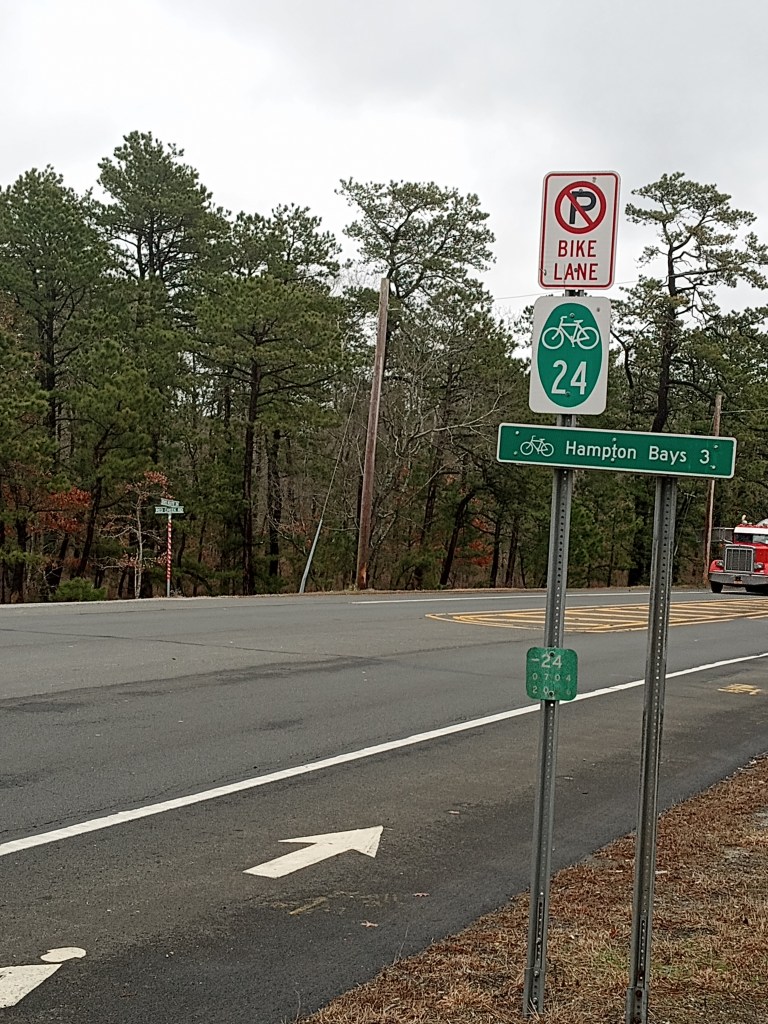
* An exception is the Flanders Road (State Hwy 24) lanes from Hampton Bays, as seen in the photo above. But with no barriers to the 55 mph (and higher) traffic, it is not inviting to most cyclists.
**Neely retired from the post but remains active as a transportation adviser to the town (and serves on its planning board). He ran for highway superintendent in 2021 and was narrowly defeated.
